Since the mid-1960s, astronauts have been photographing Egypt from their
unique vantage point. The photographs I have selected for this page put
Egypt in the context of its surrounding region and show the country from
the Nile Delta in the north to Lake Nasser in the south.
All images are courtesy of the U.S. National Aeronautics and Space Administration (NASA).
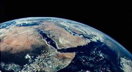
View of Egypt and adjacent countries photographed by the Apollo 17
astronauts on their coast toward the Moon. (9 December, 1972)
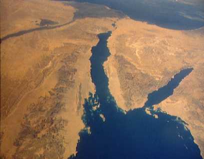
Panoramic view from a Space Shuttle of the entire Sinai Peninsula
and the nearby Nile Delta. The Suez Canal, at the top of the scene just
to the right of the Delta, connects the Mediterranean Sea with the Gulf
of Suez on the west side of the Sinai Peninsula and the Gulf of Aqaba is
on the west where they both flow into the Red Sea. (13 October, 1984)
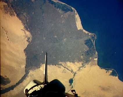
The Nile Delta contains some of the richest farm land in the world.
The capital city of Cairo is at the apex of the delta. Giza, home of the
Great Pyramid, is just to the left of the city of Cairo and the Suez Canal
is just to the right of the delta. The large dark patch in the lower left
is the Faiyum Oasis. Photographed by a Space Shuttle crew with the aft
end of the shuttle in view. (13 October, 1984)
When this photograph was taken during the STS-56 mission of the Space
Shuttle Discovery, the crew was about to capture an astronomy satellite
(gold object) above the Nile River Valley. This view reveals the landscapes
of the Sinai and the Gulf of Suez on the right. The Nile River Valley and
the base of the delta dominate the scene, while the leaf-like appearance
of the Faiyum Oasis is clearly seen to the west of the Nile. The city of
Cairo is at the base of the delta. The photograph's coverage extends to
just south of the town of Asyut. (17 April, 1993)
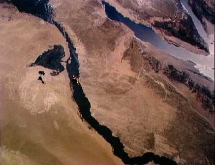
Upper Egypt and Lake Nasser are shown in this Space Shuttle mission
photograph. The Aswan High Dam is in the middle of the scene with the islands
of the First Cataract and the town of Aswan just above. The controversial
dam was built to provide cheap hydroelectric power and to regulate the
historically uneven flow of the Nile River. Note the contrast between the
largely base rock desert east of the Nile versus the sand covered desert
west of the river. (11 August, 1991)
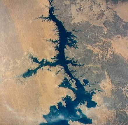
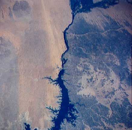
The waters of Lake Nasser back up behind the Aswan High Dam in this
Space Shuttle view. The dam is just visible at the top of the picture.
(8 August, 1992)